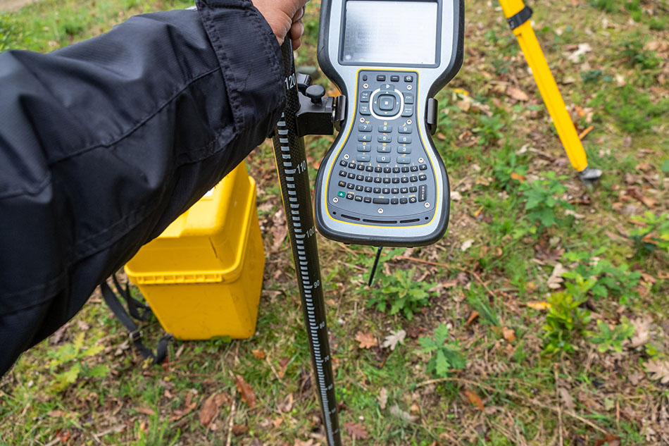
Choosing the best outdoor mapping company for property boundary and access data starts with finding a professional land surveying team that understands boundaries, access routes, mapping technology, and the purpose of the project. Accurate property boundary information can help property owners, developers, engineers, contractors, and public agencies make informed decisions before planning, design, construction, or improvements begin.
A qualified outdoor mapping company should provide:
• Boundary survey experience
• Topographic mapping and site data
• GPS, drone, and laser scanning capabilities
• Clear deliverables for planning and design teams
• Knowledge of easements, access, legal descriptions, and site constraints
The right mapping partner does more than collect field data. It helps turn property information into useful, reliable documentation. When property boundary lines, access points, terrain, and site features are properly mapped, the entire project team can move forward with greater clarity and fewer avoidable delays.
At Cinquini & Passarino, Inc., we understand that property decisions depend on accurate information. Before a site can be developed, improved, divided, accessed, or evaluated, the people involved need to know what is there, where it is located, and how the land can be used.
Outdoor mapping is more than a visual record of a property. It connects field measurements, boundary and title research, site features, access information, and mapping technology into a usable picture of the land. For projects throughout Santa Rosa, Healdsburg, Napa, Oakland, and the greater Bay Area, that information can shape everything from early planning to final construction.
Start With Accurate Property Boundary Information
Property boundary data is one of the most important starting points for land planning. It helps identify where one parcel ends and another begins, which can affect design, fencing, improvements, access, easements, setbacks, and future use.
A boundary survey may be needed for residential parcels, commercial sites, vineyard properties, subdivisions, infrastructure work, and public projects. In each case, the goal is to establish reliable information based on records, field measurements, and professional analysis.
Accurate property boundary data can help clarify:
- Parcel limits
- Potential encroachments or conflicts
- Easement locations
- Access routes
- Improvement placement
- Right-of-way concerns
Without dependable boundary information, project teams may make decisions based on assumptions. That can lead to redesigns, permitting delays, neighbor disputes, or costly changes after work has already started.
Look for Mapping That Supports the Whole Site
A strong outdoor mapping company should look beyond boundary lines alone. Many projects also need topographic data, access information, visible site features, utilities, terrain changes, and existing improvements.
Topographic surveys and mapping help show the shape and condition of the land. This information can support engineers, architects, contractors, developers, municipalities, and property owners as they evaluate what is possible on a site.
Depending on the project, mapping may include:
- Buildings and structures
- Roads, driveways, and access points
- Slopes and elevation changes
- Drainage features
- Trees, fences, and visible improvements
- Utility-related surface and subsurface features
When this information is collected clearly, the planning process becomes more practical. Design teams can work from better data, contractors can understand field conditions, and owners can make decisions with fewer unknowns.
Understand Why Access Data Matters
Access can be just as important as the property boundary itself. A parcel may look straightforward on paper, but roads, easements, driveways, slopes, gates, terrain, or neighboring properties can affect how people and equipment reach the site.
Access data is especially valuable for rural parcels, vineyard properties, larger developments, construction sites, and infrastructure corridors. It can help determine how a site functions and what limitations may need to be addressed early.
For many projects, access mapping can support questions such as:
- Where is the legal or practical access point?
- Are there easements that affect use?
- Can vehicles, crews, or equipment reach the needed areas?
- Are there grade changes or physical barriers?
- Does access align with future planning or construction needs?
Clear access information helps prevent confusion between what appears usable and what is actually supported by field conditions, recorded documents, or site layout.
Choose Technology That Matches the Project
Modern land surveying and outdoor mapping rely on the right tools for the job. Different sites require different methods, and the best results come from matching the technology to the project goals.
GPS, robotic total stations, drones, laser scanners, and CAD-based mapping can all play a role. A small residential boundary survey may require a different approach than a large right-of-way project, subdivision, vineyard site, or infrastructure corridor.
Technology can improve efficiency, detail, and documentation, but it should always be guided by professional judgment. Field data still needs to be reviewed, interpreted, and translated into clear deliverables that owners and project teams can actually use.
That is where experience matters. A mapping company should understand not only how to collect data, but how that data will be used in planning, permitting, design, legal descriptions, construction, or future property decisions.
Make Sure the Deliverables Are Clear and Useful
Good mapping should not leave the client guessing. The final deliverables should be clear, accurate, and appropriate for the next step of the project.
Depending on the scope, deliverables may include maps, plats, CAD files, legal descriptions, boundary information, topographic data, access documentation, or exhibits for planning and review. The right format matters because different professionals rely on the information in different ways.
Before work begins, it is helpful to ask:
- What type of survey or mapping is needed?
- What information will be shown?
- Who will use the final documents?
- Are legal descriptions or plats required?
- Will the data support design, permitting, construction, or ownership decisions?
Clear expectations help ensure the mapping process produces the right information, not just more information.
Move Forward With Better Land Data
The best outdoor mapping company for property boundary and access data is one that combines technical skill, field experience, mapping technology, and a clear understanding of how land information is used. Good data helps reduce uncertainty, support better planning, and prevent avoidable problems later.
At Cinquini & Passarino, Inc., we provide professional land surveying and mapping services for clients throughout Santa Rosa, Healdsburg, Napa, Oakland, and the greater Bay Area. If you need property boundary data, access information, topographic mapping, or related surveying support, contact our team to discuss your project and the next steps.