Overcoming Challenges in Railroad Surveying
with Advanced Technology, Precise Data & Modern Techniques
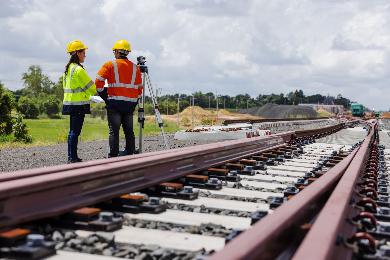
Railroad surveys play a pivotal role in the development and maintenance of rail lines, supporting safer, more efficient rail operations and long-term infrastructure planning. In this blog post, Cinquini & Passarino, Inc. (C&P) explores why railroad surveys are necessary, the challenges faced by surveyors in this specialized field, and how advanced railroad surveying technology and data-driven techniques help surveyors overcome these challenges.
Why Are Railroad Surveys Needed for Safe, Efficient Rail Networks?
Surveys along Railroad Corridors play a crucial preliminary step before creating any drawings of potential railway paths or rehabilitation of existing railways. They offer vital information and high-accuracy measurements for determining the best route. This can include details about the area’s topography, geographic limitations, track geometry, and existing infrastructure, in addition to determining boundaries and right-of-way. This information helps engineers design rail routes that are both efficient and safe while meeting regulatory and industry standards.
In a perfect scenario, a railroad would run in a straight line without changes in elevation or curves. However, in real-world conditions, geographic obstacles make this nearly impossible. That’s why accurate railroad surveying data is essential for both new rail construction and existing corridors. In addition to plotting the most efficient course for the rail line, railroad surveys are essential for monitoring and maintaining existing railroads. These surveys can identify potential issues like track deformations, erosion, and other environmental factors that may impact safety and performance. This supports proactive maintenance, capital planning, and long-term asset management.
Challenges in Surveying Railroads (and Why Precision Matters)
Surveying railroads presents a unique set of challenges compared to other types of land surveys. One significant challenge is the linear nature of railroad tracks, which requires precise measurements over long distances. Rail corridor surveys may extend for tens or even hundreds of miles, making consistency, control, and data management critical.
The terrain around railroads can also be challenging, ranging from urban environments with complex infrastructure to remote areas with difficult access. Furthermore, the dynamic nature of rail systems, including vibrations from passing trains, adds complexity to the surveying process. These factors can often limit access windows due to train schedules, safety protocols, and flagging requirements.
Another challenge is the need for accurate alignment and elevation data, as even slight deviations can result in operational issues or safety concerns. Additionally, dense vegetation along railway corridors can obstruct surveyors’ line of sight and hinder data collection, making traditional methods slower, riskier, and less efficient without the right technology. Meeting tight construction tolerances, railroad-owner standards, and Federal Railroad Administration (FRA) requirements adds another layer of complexity to every project.
Overcoming Surveying Challenges with Advanced Railroad Surveying Technology & Techniques
Cinquini & Passarino, Inc. excels in overcoming these challenges using state-of-the-art technology and advanced surveying techniques designed specifically for the rail environment, including:
- Trimble GEDO Railroad Measurement and Laser Scanning System: Enhances the precision of survey data collection with millimeter accuracy for track geometry, alignment, and elevation. Improves confidence in design and maintenance decisions.
- Track As-Builts: Ensures accurate documentation of as-built conditions for effective maintenance and future planning. Creates a reliable record for design verification, rehabilitation, and capacity upgrades.
- Topographic Mapping: Provides detailed insights into surrounding terrain for planning optimal and safe rail routes. Helps engineers understand how adjacent features, drainage, and slopes affect the track.
- Right -of -Way Surveys: Identifies and evaluates available land for rail development, ensuring accurate space allocation for tracks, utilities, access roads, and future expansion. Ensures that the design of improvements does not encroach on to adjacent land owned by others.
- Geometry Reports: Addresses concerns related to track alignment, curvature, and geometric parameters for smooth train operations. Supports speed increases, ride quality improvements, and safety assessments.
- Construction Staking: Facilitates accurate placement of elements during construction, minimizing errors in the building process. Helps contractors meet design tolerances in challenging field conditions.
- Pre-Tamping Surveys: Identifies areas requiring tamping before track maintenance, enabling targeted and precise tamping so maintenance crews can focus efforts where they will have the greatest impact.
- Clearance Analysis: Addresses concerns related to clearances between structures and the rail line. Ensures safe passage for trains and supporting projects involving double-stacking, new bridges, or overhead utilities.
- Tamping Analysis: Assesses the effectiveness of tamping operations on the track. Provides data for optimized tamping processes and long-term track stability.
Unmanned Aerial Vehicles (UAVs or drones) have also become powerful tools for railroad surveys. They can access hard-to-reach areas, capture high-resolution imagery, and generate accurate 3D models that aid in track inspection and maintenance planning. When combined with LiDAR, GNSS, and mobile laser scanning workflows, UAVs help C&P deliver comprehensive corridor mapping with minimal disruption to rail operations.
C&P: Decades of Expertise in Railroad Surveying Excellence
Navigating the complexities of railroad surveying demands unparalleled expertise. With a legacy of excellence spanning over 70 years, Cinquini & Passarino, Inc. brings a wealth of experience. This makes our team the go-to choice for railroad projects across the Western United States. We not only meet but exceed the challenges posed by railroad surveys. C&P consistently delivers precise and reliable survey data for track geometry, right-of-way mapping, topographic surveys, construction staking, and as-built documentation.
Backed by a proven track record and a steadfast commitment to employing state-of-the-art technology, C&P emerges as your trusted partner in guaranteeing the safety and efficiency of vital transportation networks. Whether you’re planning a new rail extension, upgrading existing infrastructure, or supporting ongoing maintenance programs, our railroad surveying team can help you move from concept to completion with confidence. Contact us today and witness firsthand the transformative impact that decades of expertise and an unwavering dedication to innovation can bring to your project.